Chapter One · 1796 to 1860
A City Rises from the Reserve
In the summer of 1796, a surveying party led by General Moses Cleaveland pushed through the dense forest of the Connecticut Western Reserve and arrived at the mouth of the Cuyahoga River. What they found was a bluff above Lake Erie: windswept, wild, and full of promise. Within three generations, it would be one of the most important cities in America.
The Man Who Named the City
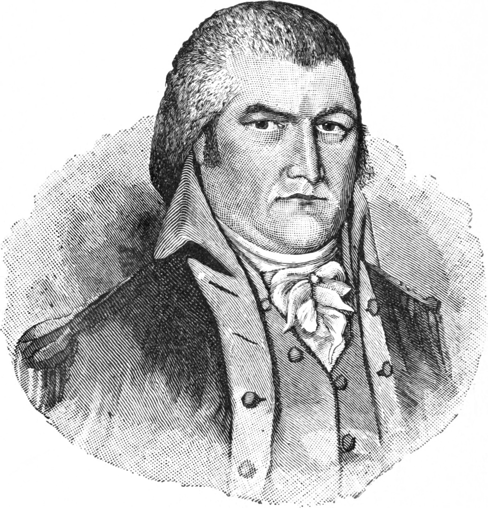
Moses Cleaveland
A Connecticut lawyer and Revolutionary War veteran, Cleaveland led the survey expedition on behalf of the Connecticut Land Company. He platted the city on the east bank of the Cuyahoga in the style of a New England town, with a grand public square at its center, a design that endures to this day.
He never returned after 1796. The city he founded lost a letter from his name when a local newspaper found "Cleaveland" too long for its masthead. Cleveland was born.
July 22, 1796 · East Bank of the Cuyahoga
The Landing
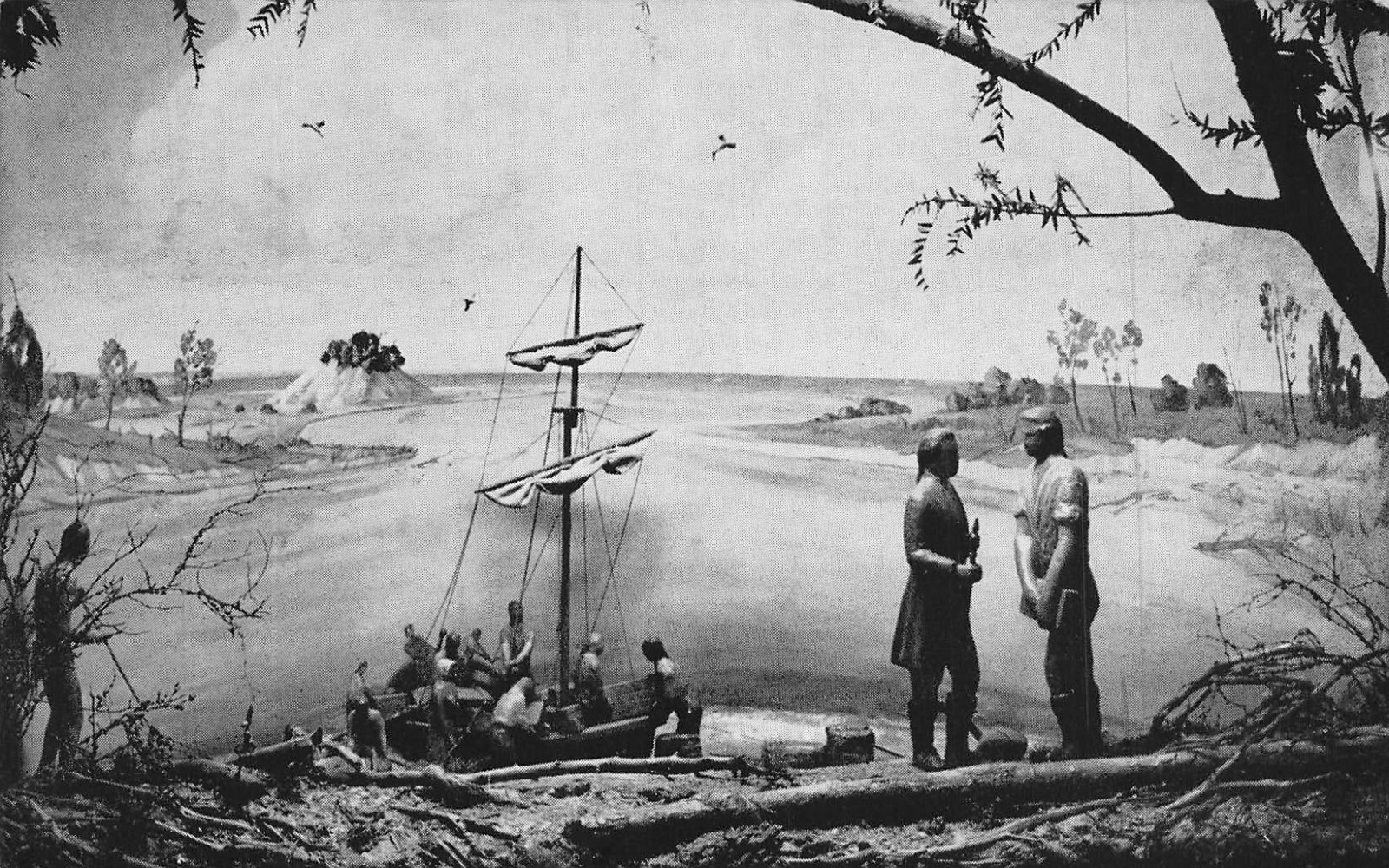
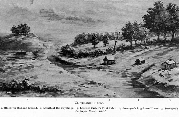
On the morning of July 22, 1796, Cleaveland and a water party steered their bateaux off the open lake and into the mouth of the Cuyahoga, a sand-choked, mosquito-plagued passage that bore little resemblance to the clean harbor the maps had implied. They landed on the east bank, climbed the bluffs above the river valley, and looked out over a landscape of chestnut, oak, walnut, and maple forest running to the horizon.
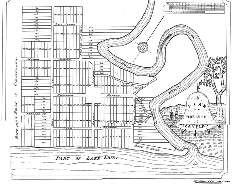
What Cleaveland saw from the heights was, by any measure of 18th-century commercial geography, an exceptional site. River to the west, lake to the north, deep hardwood soil underfoot, and the unmistakable geography of a future canal route south to the Ohio River. He had his answer. His surveyors, Seth Pease and Amos Spafford chief among them, would spend the next weeks laying out the streets and 9.5-acre Public Square of the town that would bear his name.
Location
Foot of St. Clair Ave. at the Cuyahoga
Coordinates
41°29.806′N · 81°42.032′W
Party Size
~50 persons
Today
Settler’s Landing Park, The Flats
Settler’s Landing: The Full Account
Journal excerpts, survey party roster, the Buffalo Creek treaty negotiations, the malarial river mouth, Seth Pease’s field notes, and the decision that fixed the location of a city.
Read the full history →The People Who Were Already Here
Long before Moses Cleaveland's surveying party set foot on the bluffs above Lake Erie, the land was home to Indigenous peoples who had lived along its rivers and shoreline for generations. The Erie people had once inhabited the southern shores of the lake that bears their name, but were decimated by war with the Iroquois Confederacy by 1656. In the centuries that followed, the Wyandot, Lenape, Ottawa, and Seneca peoples moved through and settled the Cuyahoga Valley, the river corridor that would one day become the beating heart of Cleveland.
Among the most significant inhabitants encountered by the 1796 expedition were the Massasagoes, a tribe living in a village near the mouth of Conneaut Creek, the same creek where Cleaveland's party first made landfall on July 4, 1796. Their presence was no surprise to the surveyors; it was a confrontation they had prepared for.
"We assured them that they should not be disturbed in their possessions; we would treat them and their friends as our brothers."
— Moses Cleaveland, journal entry, June 27, 1796
On June 27, 1796, Chief Paqua of the Massasagoes summoned Cleaveland to a formal meeting and challenged the white men's claim to the surrounding land. Cleaveland invoked his prior agreement with the Iroquois chiefs at Buffalo Creek (Red Jacket, Joseph Brant, and Farmer's Brother among them) who had relinquished their claim to the land as far as the Cuyahoga River, despite never having signed the Treaty of Greenville. To the Massasagoes, Cleaveland offered wampum, silver trinkets, and whiskey, valued at roughly twenty-five dollars, in exchange for safe passage to explore the Cuyahoga. Chief Paqua, in turn, presented Cleaveland with a ceremonial pipe as a gesture of peace.
Cleaveland's own journals describe the Massasagoes in the dismissive terms common to men of his era and station. But contemporary accounts tell a different story: P.D. Cherry's The Western Reserve and Early Ohio (1921) describes the tribe's village at Conneaut Creek as consisting of "some thirty well-built cabins," laid out with a regularity and neatness that defied Cleaveland's characterizations. These were not wandering bands; they were an established community, rooted in a landscape they had long called home.
The Massasagoes did not long outlast Cleaveland's passage. Following the murder of a Chippewa medicine man named Menompsy in the early years of Cleveland's settlement (the first recorded murder in the new town), the Massasagoes departed their village on Conneaut Creek and never returned to Ohio. The Wyandot and Ottawa lingered in the Cuyahoga Valley for another generation, with the last Native peoples concentrating there before departing between 1811 and 1813. The 1842 Treaty with the Wyandot removed the final Indigenous community from Ohio entirely. The land Cleaveland platted had a history that stretched back thousands of years, one that was largely erased within a few decades of his arrival.
Unclaimed Ground
Cleveland did not emerge from settled civilization; it was carved out of a legal and geographic in-between. The land that would become the city existed in a peculiar limbo: the Connecticut Western Reserve was a strip of northeast Ohio that Connecticut retained after ceding its other western land claims to the federal government, a remnant title that made it neither fully part of the new nation's organized territory nor truly anyone's to build on. The Connecticut Land Company purchased the Reserve in 1795 and dispatched surveyors the following year, though purchase and possession were very different things.
"The land is good, the situation pleasant, and the prospect of a town here very favorable."
— Moses Cleaveland, letter to the Connecticut Land Company, 1796
On the ground, the Reserve was raw. The Cuyahoga River, its name derived from the Mohawk word for "crooked river," was both a lifeline and a barrier. The river's winding course made navigation tricky, but its banks were rich in timber and game. The low ground near its mouth was malaria country in summer. The first settlers contended with a landscape that was beautiful but unforgiving; many early arrivals died within their first years. By 1810, the village counted fewer than 60 souls. The real transformation was still decades away.
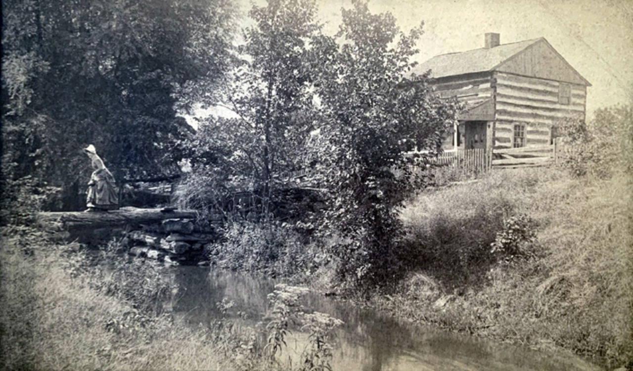
Early cabins hugged the high bluffs above the river, as settlers quickly learned to avoid the swampy lowlands that bred disease each summer. Settlement was not a steady march but a halting, uncertain thing.
The Reserve existed on paper long before it existed in fact. Its borders were surveyed, its lots parceled out to land company investors, yet for years the landscape itself remained indifferent to those claims, wild and largely uncrossed.
The Canal That Changed Everything
Ohio & Erie Canal · Completed 1832
The completion of the Ohio & Erie Canal in 1832 was the single most transformative event in early Cleveland history. Stretching 308 miles from Cleveland south to Portsmouth on the Ohio River, the canal made Cleveland the northern terminus of a trade corridor connecting the Great Lakes to the Gulf of Mexico.
Goods that once traveled by slow wagon could now move efficiently by water. Farmers, merchants, and manufacturers flooded in. Cleveland's population exploded from under 1,000 in 1830 to nearly 6,000 by 1840, a sixfold increase in a single decade.
Key Milestones
- Founding Survey1796
Moses Cleaveland and the Connecticut Land Company survey party arrive at the Cuyahoga's mouth and plat the town. - Village Charter Granted1814
The Ohio General Assembly incorporates the Village of Cleaveland on December 23, 1814. - First Municipal Election1815
On June 5, 1815, Alfred Kelley is unanimously elected the first village president of Cleaveland. - Ohio & Erie Canal Opens1832
The canal's northern terminus at Cleveland triggers a wave of commerce and immigration that transforms the city. - City Charter Granted1836
Cleveland is incorporated as a city. Population reaches roughly 6,000, establishing it as a genuine urban center. - Railroad Arrives1851
The first rail line reaches Cleveland, beginning the transition from canal commerce to the age of steam and steel. - Eve of the Civil War1860
Cleveland's population surpasses 43,000. The city is already a major industrial and commercial hub on the Great Lakes.


